Sea Science: Marine Spatial Planning is Changing the Way We Deal With Oceans and Coastlines
Authors: Mark J. Spalding and Hooper Brooks
Publication Name: Planning Practice
Publication Date: Thursday, December 1, 2011
Every planner knows this: The coastal waters of the U.S. are surprisingly busy places, with lots of overlapping uses by humans and animals alike. To reconcile those uses—and to prevent harmful ones—President Obama in July 2010 issued an executive order that established coastal marine spatial planning as a tool for improving ocean governance.
Under the order, all areas of U.S. waters would ultimately be mapped, making it clear which areas should be set aside for conservation and where new uses such as wind and wave energy facilities and open ocean aquaculture could be appropriately placed.
A legal context for this mandate is the federal Coastal Zone Management Act, in effect since 1972. That law’s program objectives remain the same: to “preserve, protect, develop, and where possible, to restore or enhance the resources of the nation’s coastal zone.” Thirty-four states operate programs under CZMA’s National Coastal Zone Management Program. Twenty-eight estuarine reserves serve as !eld laboratories under its National Estuarine Research Reserve System. Now the president’s executive order is encouraging an even more comprehensive look at coastal systems.
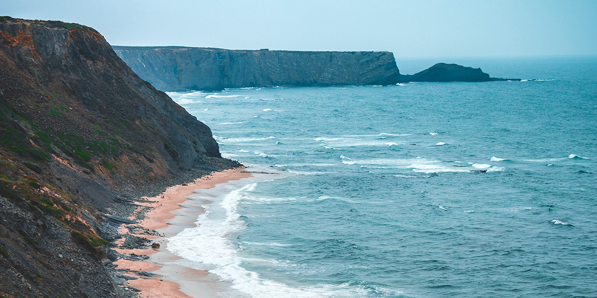
The need is there. More than half of the world’s population lives within 40 miles of a coastline. That number could climb to 75 percent by 2025, according to some projections.
Eighty percent of all tourism takes place in coastal areas, particularly along the water’s edge, on beaches and nearshore reefs. The economic activity generated in the U.S. exclusive economic zone—extending 200 nautical miles offshore—represents hundreds of billions of dollars.
This concentrated activity creates challenges for coastal communities. These include:
- Managing community stability in an unstable global economy, with uneven economic activity both seasonally and as affected by the economy and weather
- Mitigating for and adapting to the effects of climate change on coastal ecosystems
- Limiting anthropogenic impacts such as invasive species, onshore pollution, habitat destruction, and overfishing
Promise and pressures
Coastal marine spatial planning is a relatively new planning tool from a regulatory perspective. It involves techniques and challenges that have parallels in terrestrial planning, but it has unique features as well. For example, it would create speci!c boundaries within a previously open ocean space—a concept sure to irritate those wedded to the notion of a wild, open, accessible ocean.
Offshore oil and gas production, shipping, !shing, tourism, and recreation are some of the engines that drive our economy. The oceans are facing increasing pressure for development as industries compete for common spaces, and new demands arise from such uses as offshore renewable energy and aquaculture. Because federal ocean management today is divided among 23 different federal agencies, ocean spaces tend to be managed and regulated sector by sector and case by case, without much consideration for the trade-offs or cumulative effects on other human activities or the marine environment.
Some marine mapping and subsequent planning has occurred in U.S. waters for decades. Under the CZMA, the U.S. coastal zone has been mapped, although those maps may not be fully up to date. Protected areas around Cape Canaveral, nuclear power plants, or other sensitive landside zones have resulted from planning for coastal development, marinas, and shipping routes. The migratory lanes and feeding areas of the highly endangered North Atlantic right whales are being mapped, because ship strikes—a major cause of right whale death—can be greatly reduced when shipping lanes are adjusted to avoid them.
Similar efforts are under way for the ports of southern California, where ship strikes have affected a number of whale species. Under the state’s 1999 Marine Life Protection Act government officials, nonprofit organizers recreational and commercial fisherman industry representatives, and community leaders have struggled to identify which areas of California’s coast are best protected and which uses can be undertaken in other areas.
The president’s order sets the stage for a more comprehensive CMSP effort. Writing in a 2010 issue of the journal Aquatic Conservation: Marine and Freshwater Ecosystems, G. Carleton Ray of the University of Virginia explained the executive order’s aims: “Coastal and marine spatial planning provides a public policy process for society to determine better how oceans and coasts are to be sustainably used and protected now and for future generations.” The process is intended, he said, “to carefully maximize what we get out of the ocean while minimizing the threats to its health. A significant, foreseen benefit is improvement of the ability of various authorities to coordinate seamlessly their objectives by means of broader planning.”
Included in the executive order are the nation’s territorial sea and exclusive economic zone, the Great Lakes, and the continental shelf, extending landward to the mean high-water line and including inland bays and estuaries.
What’s required?
The process of marine spatial planning is not unlike that of a community charrette where all the stakeholders come together to discuss both how areas are currently used and how additional uses, or development, might occur. Often the charrette begins with a particular frame, as in how a community is going to meet the challenge of providing the infrastructure for a healthy economy, environment, and society.
The challenge in the marine realm is ensuring that the charrette represents those species on whom economic activity depends (e.g., fishing and whale watching); whose ability to show up at the table is obviously limited; and whose options, when the wrong decisions are made, are even more limited. Further, temperature and chemistry changes, as well as destruction of habitat, can cause shifts in the location of !sh and other marine animal populations, making it hard to identify specific areas as being for specific uses.
Marine spatial planning can be very expensive, too. A comprehensive plan for a given area has to take many elements into account. It involves developing tools for assessing the multidimensional ocean that measure the surface, the tidal zone, the adjacent habitats, the ocean floor, and areas beneath the ocean floor, as well as any overlapping jurisdictions in a given area. Fishing, mining, oil and gas production, areas that are leased for oil and gas but not yet in use, wind turbines, shellfish farms, shipping, recreation, whale watching, and other human uses have to be mapped. So too do the routes used to get to the areas for those uses.
Comprehensive mapping would include the types of vegetation and habitat along the coastline and in nearshore waters, such as mangroves, seagrass meadows, dunes, and marshes. It would illustrate the ocean “oor from the high-tide line out past the continental shelf, known as the benthic communities, where many species of !sh and other animals spend part or all of their life cycle. It would assemble the known spatial and temporal data about !sh, mammal, and bird populations and migratory patterns and the areas used for spawning and feeding. Identifying the nursery areas most used by juvenile !sh and other animals is also important. The temporal element is particularly important in serious ocean stewardship, and often overlooked in CMSP mapping.
“CMSP intends to be, or hopefully will become, fundamentally science-driven and Scientific missions occur eight months a year at Aquarius Reef Base, the world’s only undersea research station, adaptive in response to new evidence, technology, and understanding,” Ray wrote. One objective is to enable the identification of places in which new uses, such as energy production or conservation areas, might be sited. Another objective is to ensure that the existing users identify and understand how and where their activities take place within the mapped area.
If possible, the migration routes of birds, sea mammals, sea turtles, and !sh would also be included so that their corridors of use would be highlighted. The goal is to use these layers of information to provide stakeholders and planners a tool by which to reach consensus and make plans that optimize benefits to all.
What’s been done so far?
To launch the nationwide marine spatial planning effort, the federal government last year established an interagency National Ocean Council whose governance coordinating committee, in consultation with 18 members from state, tribal, and local governments and organizations, is to serve as a key coordinating body on inter jurisdictional ocean policy issues. Marine spatial plans are to be developed for nine regions as early as 2015. Listening sessions were held all over the country earlier this year to get input on the CMSP process. That effort is a good start, but various advocacy groups are asking for more. In a letter addressed to Congress in late September, the Ocean Conservancy—a Washington-based nonprofit—noted that many states were already collecting data and creating maps of ocean and coastal uses. “But,” the letter stated, “the states cannot !x our nation’s ocean management system on their own. Given the inherent role of the federal government in federal ocean waters, the federal government must build on existing regional efforts to help guide ocean development in sensible ways.” An account of the effort already under way in Massachusetts was provided by Amy Mathews Amos, an independent environmental consultant, shortly after the president’s executive order was issued last year. “For decades communities have used zoning to reduce land-use conflicts and protect property values. In 2008, Massachusetts became the first state to apply this idea to the ocean,” Amos wrote in “Obama Enacts Ocean Zoning,” posted in 2010 at www.blueridgepress.com, an online collection of syndicated columns. “With the state’s passage of a comprehensive ocean ‘zoning’ law, it now has a framework to identify which offshore areas are appropriate for which uses, and to flag potential conflicts in advance.”
Much has been accomplished in the three years since the Massachusetts Ocean Act required the state government to develop a comprehensive ocean management plan that is intended to be incorporated into National Oceanic and Atmospheric Administration’s existing coastal zone management plan and enforced through the state’s regulatory and permitting processes. First steps include determining where specific ocean uses will be permitted and which ocean uses are compatible.
To facilitate the process, the state created an Ocean Advisory Commission and Science Advisory Council. Public input sessions were scheduled in coastal and inland communities. Six agency work groups were formed to acquire and analyze data regarding habitat; !sheries; transportation, navigation, and infrastructure; sediment; recreation and cultural services; and renewable energy. A new, online data system called MORIS (Massachusetts Ocean Resource Information System) was created to search and display spatial data pertaining to the Massachusetts coastal zone.
MORIS users may view various data layers (tide gauge stations, marine protected areas, access points, eelgrass beds) over a backdrop of aerial photographs, political boundaries, natural resources, human uses, bathymetry, or other data, including Google base maps. The goal is to allow coastal management professionals and other users to create maps and download the actual data for use in a geographic information system and for related planning purposes.
Although the preliminary management plan for Massachusetts was issued in 2010, much of the data collection and mapping was incomplete. Efforts are under way to develop better commercial !sheries information, and to !ll other data gaps such as continuing collection of habitat imagery. Funding limitations have halted some areas of data collection, including habitat imagery, since December 2010, according to the Massachusetts Ocean Partnership.
MOP is a public-private group established in 2006 and supported by foundation grants, government contracts, and fees. It operates under a governing board, with a team of half a dozen core staff and several subcontracted professional service teams. It has big goals, including science-based ocean management throughout the Northeast and nationally. The partnership’s primary activities include: CMSP program design and management; stakeholder engagement and communications; data integration, analysis and access; trade-off analysis and decision support; tool design and application; and ecological and socioeconomic indicators development for CMSP.
Massachusetts is expected to issue its final comprehensive ocean management plan in early 2015, and MOP hopes that a New England Regional Plan will be completed by 2016.
Rhode Island is also moving ahead with marine spatial planning. It has developed a system of mapping human uses and natural resources and has worked to identify compatible uses through the frame of wind energy siting.
A state-commissioned study completed some years ago determined that offshore wind farms could supply 15 percent or more of Rhode Island’s electricity needs; the report also identified 10 specific areas that were potentially suitable wind farm locations. In 2007, then governor Donald Carcieri invited a diverse group to participate in discussions regarding the 10 potential sites. Four meetings were held to receive input from the attendees, who represented local governments, environmental organizations, local economic development organizations, and commercial fishing interests as well as state agencies, the U.S. Coast Guard, area universities, and others.
A major goal was to avoid potential conflicts. For example, careful attention was paid to the routes and practice areas of the America’s Cup contenders and other sailing interests, among the many mapped uses. It was harder to acquire information on U.S. Navy submarine routes out of the nearby base, but eventually, those routes were added to the mix. Of the 10 areas identified before the stakeholder process, several were eliminated due to potential conflicts with existing commercial uses, especially fishing. However, the initial maps did not show participants the migratory patterns of animals or include a temporal overlay of seasonal use.
Different groups had different concerns about the potential sites. Lobstermen worried about the effect of building and maintaining structures at all 10 sites. One area was found to be in conflict with a sailing regatta site. Tourism officials expressed concerns about the potential adverse impacts on tourism from nearshore wind development, particularly near the south shore beaches, which are a significant economic resource for the state. The views from those beaches and from summer communities on Block Island were among the reasons cited for moving the wind farms elsewhere.
Others were concerned about the “Coney Island effect” of the Coast Guard requirements for lighting the turbines as a warning to planes and boaters and the potential onshore nuisance of required foghorns.
Only some of those disputes were resolved before the first wind energy developer began its own ocean floor mapping exercise in September 2011, with plans to formally propose sites for both a 30-megawatt wind farm in 2012 and, later, a 1,000-megawatt wind farm in Rhode Island waters. State and federal agencies will review those proposals. It remains to be seen which human or animal uses will be prioritized, since wind farms are off-limits to boating and fishing.
Other states are also undertaking specific marine spatial planning efforts: Oregon is focusing on marine protected areas and ocean wave energy siting; California is about to implement its Marine Life Protection Act; and Washington State’s new law requires that state waters undergo a marine spatial planning process, once funds are available to support it. New York is completing implementation of its 2006 Ocean and Great Lakes Ecosystem Conservation Act, which shifted management of the state’s 1,800 miles of marine and Great Lakes coastline a more comprehensive, ecosystem-based approach, rather than one stressing a particular species or problem.
Planner’s role
Land and sea are integrated systems; they cannot be managed separately. The coast is where more than half of us live. And the coastal zones are the most productive of our planet. When the coastal systems are healthy, they provide billions of dollars in direct economic benefits, including jobs, recreation opportunities, wildlife habitat, and cultural identity. They can also help protect against natural disasters, which also have real economic consequences.
Thus, the CMSP process must be wellbalanced, well-informed, and consider ecological, sociocultural, and economic values and bene!ts. Coastal community planners need to be integrated into the discussion of CMSP to ensure community access to ocean space and resources, as well as protection of marine ecosystem services that in turn will contribute to sustainable coastal economies.
The operational, technical, and scientific expertise of the planning community should be combined and applied to best bene!t informed CMSP decisions. Such involvement must start early in the process, when government and stakeholder bodies are being formed. The expertise of the planning community can also help leverage the financial resources needed to complete comprehensive CMSP in these economically strained times. Further, planners can help ensure that the maps themselves are updated as time goes by.
Finally, we can also hope that such engagement will help to increase understanding, support, and an expanded constituency for protecting our threatened oceans.
Mark Spalding is the president of The Ocean Foundation, based in Washington, D.C. Hooper Brooks is the New York and London-based director of international programs for the Prince’s Foundation for the Built Environment.
Read More

TITANIC LAW AND POLICY: How a Shipwreck Changed International Law — and Why It Matters Today
On the night of April 14–15, 1912, more than 1,500 people died in the icy waters of the North Atlantic when the RMS Titanic slipped beneath the surface. The world …

Women Lighthouse Keepers of the U.S.
About Women’s History Month Women’s History Month originated from a local week-long celebration in California in 1978. The organizers chose the week of March 8th to correspond with International Women’s …