Part 1: Storm Surge: When the Ocean Comes Ashore
By Angel Braestrup, Chair, Board of Advisors, The Ocean Foundation
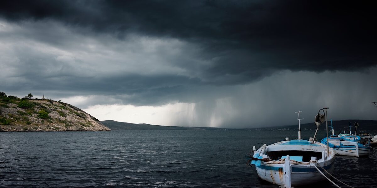
We’ve all seen the pictures and videos. Some of us have even witnessed it firsthand. A big storm pushes water ahead of it as it churns its way up the coast, the strong winds making the water pile up on itself until it hits the shore and then it rolls inward, depending on how fast the storm has been moving, how long the strong winds have been pushing the water, and the geography (and geometry) of where and how it hits the coast.
Storm surge is not part of the calculation of the strength of storms, such as the hurricane’s “Saffir Simpson Hurricane Wind Scale.” Most of us know Saffir Simpson defines the Category 1-5 designation hurricanes receive depending on sustained wind speed (not the physical size of a storm, speed of the storm’s movement, dynamic pressure, burst wind speeds, nor amount of precipitation etc.).
The National Oceanic & Atmospheric Administration (NOAA) has developed a model known as SLOSH, or The Sea, Lake and Overland Surges from Hurricanes to project surges, or, as important, to enable researchers to compare the relative effects of different storms. Some relatively weak storms can create a remarkable storm surge when landforms and water levels merge to create the perfect conditions. Hurricane Irene was a category 1 when she made landfall at North Carolina[1] in 2011, but her storm surge was 8-11 feet and she caused a lot of damage. Likewise, Hurricane Ike was a good example of a storm that was “only” a category 2 (110 mph sustained winds) when it hit land, but had the storm surge that would have been more typical of a strong category 3. And, of course, most recently in November in the Philippines, it was the storm surge of Typhoon Haiyan that wiped out entire cities and left in its wake, the devastated infrastructure, food and water delivery systems, and piles of debris that have so shocked the world in film and photos.
On the east coast of England in early December 2013, massive flooding damaged more than 1400 houses, disrupted the railway system, and gave rise to serious warnings about contaminated water, rat infestations, and the need to be careful about any standing water in gardens or elsewhere. Their largest storm surge in 60 years (to the day!) also did considerable harm to the wildlife preserves of the Royal Society for the Protection of Birds (RSPB)—saltwater inundation of freshwater lagoons affecting the wintering grounds of migratory birds and may affect the spring nesting season of birds (such as bitterns).[2] One reserve was mostly protected thanks to a recently completed flood control project, but it still suffered significant damage to the dunes that separated its freshwater areas from the sea.
Hundreds of people on the east coast of England died in 1953 as the water poured into defenseless communities. Many credit the response to that event with saving hundreds, if not thousands, of lives in 2013. Communities built defense systems, including emergency communications systems, which helped assure that preparations were in place to notify people, evacuate people, and to rescue where needed.
Unfortunately, the same cannot be said for the grey seal nurseries where pupping season is just ending. Great Britain is home to a third of the world’s grey seal population. Dozens of baby grey seals were brought to a rescue center operated by the Royal Society for the Prevention of Cruelty to Animals (RSPCA) because the storm surge separated them from their mothers. These young pups are too young to be able to swim properly and thus they were particularly vulnerable. They may need care for as long as five months until they are ready to feed on their own. It is the biggest rescue effort the RSPCA has ever had to undertake. (Donate to our Marine Mammal Fund to help protect these animals.)
Another source of a significant flood event from the ocean is, of course, an earthquake. Who can forget the devastation from the tsunami in Indonesia, Thailand, and around the region in the wake of the Christmas week earthquake in 2004? It remains one of the most powerful earthquakes ever recorded, certainly among the longest in duration, and not only did it move the whole planet, but it also triggered smaller earthquakes half a world away. The residents of nearshore Indonesia had almost no chance to escape the 6 foot (two meter) wall of water that rushed ashore within minutes of the quake, the residents of the east coast of Africa fared better, and the coast of Antarctica better still. Coastal Thailand and coastal areas in India were not hit for more than an hour, and in some areas, longer. And again, the wall of water rushed inland as far as it could and then receded, almost as quickly, taking with it a large portion of what had been destroyed on its way in, or, weakened, on its way out again.
In March 2011, another powerful earthquake off of eastern Japan generated a tsunami that reached as high as 133 feet as it came ashore, and rolled inland nearly 6 miles in some places, destroying everything in its path. The quake was so powerful that the island of Honshu, the biggest of Japan’s islands, was moved about 8 feet east. The tremors again were felt thousands of miles away, and the resulting tsunamis harmed coastal communities in California, and even in Chile, some 17,000 miles away, the waves were over six feet high.
In Japan, the tsunami moved giant tankers and other ships from their berths far inland, and even pushed the giant seashore protection structures known as tetrapods that rolled with the waves across communities—a form of protection that became a cause of the harm. In coastal engineering, tetrapods represented a four-legged advance in breakwater design because the waves usually break around them, reducing the damage to the breakwater over time. Unfortunately for the coastal communities, the tetrapod breakwaters were no match for the power of the sea. When the water had receded, the sheer size of the disaster began to emerge. By the time the official counts were completed, we knew that tens of thousands of people were dead, injured, or missing, that nearly 300,000 buildings as well as electric, water, and sewage utilities were destroyed; transportation systems had collapsed; and, of course, one of the longest running nuclear accidents had begun at Fukushima, as the systems and the back up systems failed to withstand the onslaught from the sea.
The aftermath of these huge ocean surges is part human tragedy, part public health problem, part natural resource destruction, and part systems collapse. But before repairs can even begin, there is another challenge that looms. Every photo tells part of the story of thousands of tons of debris—from flooded cars to mattresses, refrigerators, and other appliances to bricks, insulation, wiring, asphalt, concrete, lumber, and other building materials. All of those tidy boxes we call houses, stores, offices, and schools, turned into soggy, smaller, largely useless piles of rubble soaked with seawater and a mixture of the contents of buildings, vehicles, and water treatment facilities. In other words, a big smelly mess that must be cleaned up and disposed of before rebuilding can begin.
For community and other government officials, it is hard to anticipate response to the next storm without considering how much debris might be generated, the degree to which the debris will be contaminated, how it will have to be cleaned up, and where the piles of now useless materials will disposed of. In the wake of Sandy, the debris from the beaches in one small coastal community alone towered above our heads after they had been sifted, sorted, and the cleaned sand returned to the beach. And, of course, anticipating where and how water will come ashore is also tricky. As with the tsunami warning systems, investing in NOAA’s storm surge modeling capacity (SLOSH) will help communities be more prepared.
Planners can also benefit from the knowledge that healthy natural shoreline systems—known as soft or natural storm barriers—can help buffer the effects of surge and diffuse its power.[3] With healthy seagrass meadows, marshes, sand dunes, and mangroves for example, the force of the water may be less destructive and result in less debris, and fewer challenges in the aftermath. Thus, restoring healthy natural systems along our coasts provides more and better habitat for our ocean neighbors, and can provide human communities with recreational and economic benefits, and, mitigation in the wake of disaster.
[1] NOAA’s Introduction to Storm Surge, http://www.nws.noaa.gov/om/hurricane/resources/surge_intro.pdf
[2] BBC: http://www.bbc.co.uk/news/uk-england-25298428
[3]Natural defenses can best protect coasts, http://www.climatecentral.org/news/natural-defenses-can-best-protect-coasts-says-study-16864
Read More

Arab Maritime Heritage
Arab Maritime Heritage: Navigators of the Indian Ocean April has been recognized as Arab American Heritage Month. While it celebrates modern US communities, The Ocean Foundation would like to reflect …
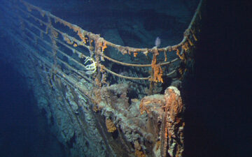
TITANIC LAW AND POLICY: How a Shipwreck Changed International Law — and Why It Matters Today
On the night of April 14–15, 1912, more than 1,500 people died in the icy waters of the North Atlantic when the RMS Titanic slipped beneath the surface. The world …